Showing posts with label Coronado national forest. Show all posts

Coronado National Forest - Finger Rock Canyon Trail

>> Tuesday, November 24, 2009


Trail info: Mileage: 9.2 miles (out and back) / Elevation (low-high): 3120-6880 / Location: At the very north end of Alvernon Rd - take Swan north to Skyline and turn left, take Skyline to Alvernon and turn right, then watch for the trail parking on the left at the top of the hill

Wow! There are few trails that I return from that have dealt me a butt kicking like this one. I doubt I've ever hiked a trail as difficult as Finger Rock. I hurt for 2 days after this hike! The trail starts off easy enough, then progresses to steep switchbacks and patches of large rocks to climb over throughout much of the journey to the top. The views and beauty of the area certainly make it worth the grueling hike. It is a spectacular trip to say the least climbing up from the desert terrain, through the canyon, and into areas of juniper and pine. Just take plenty of water and high energy food and the best pair of hiking shoes you can afford. There are not only great views of finger rock, but interesting rocky hillsides and Tucson below. A mix of clouds and sun made for an ideal hike and I made many stops to gaze at the awesome rugged landscape and put my heart back in my chest. I ran into the typical dessert wildlife such as lizards and buzzards circling, waiting for any hikers that didn't make it back. I did run into several other hikers on my trip, as this trail is popular despite being so challenging. When I reached the trail's end I enjoyed lunch, a great view, and some r-n-r before heading down. I was glad to have my head lamp with me as I didn't return until well after dark with sunset being at 5:30 these days. Hiking back under the setting sun does make for a stunning return trip on about any hike. As the bright sun slipped beneath the mountains a sliver of moon came into view and hung over the city below, just adding more beauty to this great day. However, once it's dark this trail can be tough to see, although I never had a problem other than needing to slow down my pace so as to not loose it.

  • Get travel deals here! My Rovia travel site
  • Read more...

    Chiricahua Nat'l Monument Hiking Trip

    >> Thursday, November 19, 2009


    Trail info: Echo Canyon (start), Hailstone, Mushroom Rock, Inspiration Point, Big Balanced Rock, Heart of Rocks, Sarah Deming, Lower Rhyolite Canyon (end) / Total Mileage: 9.8 / Elevation change: 6780 (start) - 6330 - 7010 - 5400 (end) generally gradual changes / Note: The best way to hike this is to sign up for the free shuttle in the visitor center which leaves at 8:30am and drops you off at the Echo Canyon trail head. You then hike back to the visitor center. (This also makes your hike mostly downhill!)

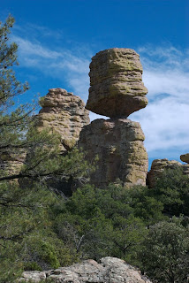
    I spent a few days camping in the Chiricahua's, but the main event was this hike combo, which I took at a leisurely pace and made a day out of it. Only through pictures or seeing it for yourself can one truly appreciate the awesomeness of this area. Out of all the places I've traveled to, this park is without question one of my all time favorites. Few trails do I return to again and again to hike, but this is one of them (I think this was my 4th time). This is a land of impressive volcanic formations that look similar to stalagmites in a cave; the Apache called these spires, "standing up rocks." These stunning pillars cover the hillside, many formed in ways as to defy gravity. The trails not only provide fantastic views of these features but place you in their midst, allowing you to walk amongst their majesty. Unlike so many trails which feature one main attraction or an endpoint with some grand view, these trails are just mile after mile of incredible scenery. The day was beautiful, although quite windy and cool at times. I kept putting on and taking off layers as I hiked. Nearing the end of the season there were few others out on the trails. I had hoped for more fall color, but there are few deciduous trees here except in the valley. The trails are well marked and easy to hike with gradual changes in elevation. This is a hike I don't like to rush as there's so much to take in. Even with a lunch break, plenty of photo stops, and the relaxed pace I hiked at, I still completed the trip in 7 hours. Most people in reasonable health should have no problems finishing this trek before sunset. After a great day of hiking it was back to camp for dinner. It was a cold night again and my equipment was just barely keeping me warm enough. I awoke the next day to snow with more on the way and ended up working my way home the long way, stopping for lunch in Tombstone, and dinner in Patagonia, before traveling a primitive road to Nogales and then returning to Tucson from there. A pretty wild journey, but fun.

    Read more...

    Santa Rita Mountains / Madera Canyon / Mt. Wrightson

    >> Tuesday, November 10, 2009

    Day 1: Madera Canyon: This was quite an adventure filled 3 day trip in an area known for its wildlife, particularly birds. My first day there was setting up camp and just some general sightseeing and locating trails. The sunset the first night was nice and I went up to the end of the road where I could observe the last light warming the mountains with its red glow. That night the winds whipped up something fierce and I thought I would wake and find I was no longer in Arizona, like in “The Wizard of Oz.” I got very little rest which was disturbing considering the next day was my big trip up the mountain. I was almost ready to pack it in the next morning but breakfast seemed to revive me and I felt ready for the trek ahead.


    Day 2: Mt. Wrightson Hike: I began early expecting that by taking the Super Trail to the top (a more gradual climb) and then the Old Baldy trail on the way back (a more steep descent) would give me about 13.5 miles of hiking for the day, most of it uphill. The hike climbs through a lot of forest with many great views along its course. There were still many areas of beautiful wildflowers despite being late in the season. Deer, birds, and copious lizards made up the wildlife I spotted on this trip. The interesting birds on this hike included some sort of Oriole (I think) and a hawk. I guess I needed mom with me to figure out what they were. The elevation didn’t really nail me until my final ascent to the summit which goes from about 8700 to 9453 in under a mile. I’m not sure I’ve ever hiked to this height before but the views along the way and at the peak made it worth it. You could see for miles in all directions up there without anything obstructing your view. No wonder back in the day there was an observation building to spot wildfires erected there. (Its remains are visible in my pic above) You even look down on the Smithsonian’s Whipple Observatory from the summit. I spent a while at the top enjoying the view (and celebrating my achievement, thanking God and everyone else like I'd won an Olympic medal or something) and a hardy snack before beginning my descent, which if timed right would have me finishing my hike as the sun was setting, providing some more nice photos of Mt. Wrightson with that late day light I love. It was a wonderful, cool descent with different views and even a few trees with golden leaves on this side of the mountain. The Baldy trail is quite steep and I was glad I had chosen it only for my return trip. It was hard to put the camera away as there were so many great overlooks along the way back. I timed the trip perfectly and was hiking most of the final couple miles of the trek under the setting sun. Then it was back to camp and dinner! This nights excitement I’ll call “Skunk Fest.” It started while sitting on the tailgate of my truck eating dinner. Hearing a noise I looked down to discover a skunk sniffing the ground below me (only inches from my dangling feet); it wandered around my truck and looked at me several times before heading off. Later I spotted an all white skunk, and then another. I spent most of my time in the truck that evening as I really didn’t want to get sprayed. I crept carefully to my tent that night, fortunately without any unpleasant encounters.


    Day 3: Madera Creek Trails: This morning I awoke to wild turkeys making their way through camp. There’s certainly plenty of action around this place! Today would be easy hikes along the (mostly dry) creek, about 7 miles total, doing each trail segment out and back. This is the area birders flock to (pun intended) during the spring. I saw quite a number of birds on my hikes but really had little to identify them. There was a woodpecker, nuthatch, a jay, a blackbird with white patches on the top of its wings, some sort of finch, and a tanager among what I spotted and recognized. My mom would really enjoy this area. The trails along the creek are easy and even paved in places with many benches for bird watching. They are also easy to access with the road being nearby allowing me to do small chunks of the trail and then return to my truck for food and to move on to the next section. Even this time of year there were places the creek had water and the wildlife was plentiful in those stretches. Besides many birds, I also encountered deer and squirrels and such while hiking. After a relaxing day of animal watching it was back to Tucson. Definitely worth coming back in the spring during birding season.

    • If you are looking to travel to Arizona or anywhere else, be sure to click over to my travel site.

    Read more...

    Coronado National Forest- Mt. Lemmon - Aspen Trails

    >> Saturday, October 31, 2009

    Circuit: Aspen Trail / Aspen Draw / Mint Spring / Marshall Gulch Loop

    Trail info.: Mileage (total loop) 8.3 miles + distance along road (?) / Elevation (low-high) appx. 7400-8600 ft

    Location: starts at Marshall Gulch Picnic Area

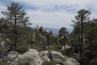
    With autumn underway I decided to check out the Aspen Trail and enjoy some fall color. The leaves were pretty close to peak color on much of Mt. Lemmon and it was a great cool day for a long loop that would lead me through much of the aspen stands on the mountain. I began at the Marshall Gulch picnic area and hiked up the Aspen Trail from there. It didn’t take long before I was immersed in the largest area of Aspen you’ll encounter on the whole trail. The leaves were dropping quickly likely because of dry conditions so I was happy I picked this for my outing. I slowly walked admiring the trees and trying to capture some of their beauty on film (err... memory card). The trail climbs gradually from the gulch and through the forest and until you pass the big trail junction where several trails converge it is not too difficult. Eventually the trail climbs fairly steeply with many switchbacks as it works its way up to radio ridge (where the radio towers are and the ski lift ends). This ascent provides some outstanding views along the way which give a good excuse to stop and catch your breath and avoid heart failure. Dropping down the Aspen Draw trail I once again wandered through some Aspen trees as I descended into the valley and the town of Summerhaven. I strolled through quite a bit of the town as I worked my way back to the Mint Spring trail to continue my loop. I was quite excited to see more aspen as I started up the Mint Spring trail. Here new aspen are growing in an area where the old growth pine forest burned away several years ago. There were also some nice views at this point in the trail. Once you curve around the slope the trail becomes nothing much other than a hike through burnt trunks of trees until it gets close to the trail junction. I then finished my trip with one of my favorite sections of trail on the mountain, Marshall Gulch. Sadly, there wasn’t much water in the stream due to the dry weather but enough to enjoy the sound of trickling water here and there. Today my hiking pace was just about perfect as I made it back to my vehicle just as it was getting dark with the glorious moon light guiding me back the last 1/8 of a mile or so.
    Read more...

    Coronado National Forest - Mt. Lemmon - Oracle Ridge + Red Ridge Trails

    >> Tuesday, September 15, 2009


    Trail info.: Length: (done as a loop - Oracle Ridge to Catalina Camp to Red Ridge) 7.3 miles (+ hike back to vehicle at trail head) appx. 2 miles = about 9.3 miles round trip, Elevation: (low-high) 5680-8160
    Location: Red Ridge trail head is off the ski road, Oracle Ridge trail head is a short distance down the control road from the fire station

    It was another beautiful day for hiking with mostly sunny skies and a gentle, cool breeze making for a pleasant temperature. At first Oracle Ridge trail passes through many burnt up trees and I figured on another trail through nothing but charred remains from the fires. However, I was delighted at the abundant wildflowers and areas that the fires missed leaving plenty of smaller plants thriving. On the positive side, even where the trees had burned, there were many unobstructed views where I could see for miles in all directions. I would say incredible views would be the prime feature of this high elevation trail.
    The trail was at times rocky and part of the way it followed what once was a rough road undoubtedly created to access Catalina Camp in the valley below. The miles ticked off quickly on this mostly level to downhill ridge top trail. It wasn't long before I made it to a trail junction with the Catalina Camp trail and began heading off down the hill. It was a bit steep and rocky in places, making me wonder how even in good condition you could get a vehicle down this road. The trail wandered on down the mountain to the camp. I was curious as to what this camp would be like as it is marked on my map but nowhere could I find any information about it. It turns out to only be a closed off 1 room shack with a storage shed nearby. More like the remains of a camp.
    Historical, yes, but nothing to offer the weary hiker in search of rest. It was apparent as I hiked around that this is a popular overnight destination; although, I never ran into another soul on my hike today. There were remains of campsites along a small stream which I'm guessing flows year round as it had quite a flow to it considering it's September. I hung out and enjoyed a snack here while listening to the soothing sounds of the stream. As I hiked on I became worried as I temporarily lost the trail and it was at times difficult to distinguish the actual trail in this area verses paths other campers had made or that water running off the mountain had created on its way to the stream. Thankfully, after some prayer and retracing my steps I found my way to the trail junction for the Red Ridge trail. (I did those that will come after me a favor by setting up some stacks of rocks particularly in the spot where I went off course.) Ahh, these mountain trails definitely have their surprises! I was expecting a well defined path on this journey, as most of my trip was on the Arizona Trail. If you were to have problems in this area, stay with the stream as it will eventually intersect the Red Ridge trail and there is a good stack of rocks marking the spot. I was a little concerned when I reached the trail signpost as someone had etched a letter "D" in front of the word "RED." Would the Red Ridge trail really be a "DRED" to hike? Not if you don't mind intense, heart-pounding, uphill stretches. The trail was well defined, easy to follow and not too rocky, but between the steepness and elevation gain I hiked at a snails pace and even then had to stop numerous times to bring my heart rate down. It was a beautiful hike offering some great views, especially of some rugged rocky cliffs which the late day light illuminated magnificently. Sunset was arriving quickly and its warm light accentuated the hills and rocky features below. I soon was off the trail and began the trip along the road back to my vehicle. Yet another blessed day and further proof that it's hard to find a hike that isn't worth taking in the Catalina Mountains.

    • If you are looking to travel to Tucson, AZ or anywhere else, be sure to click over to my travel site.
    • If you like the images you see they are available at my Zazzle gallery.
    • I have images on Flickr ! Please visit and post comments.

    Read more...

    Coronado National Forest - Linda Vista Trail

    >> Monday, August 24, 2009


    Trail info: Length: appx. 2.7 miles round trip depending on which trails you take - Elevation: (low-high) 2720-3120 - Location: Linda Vista Blvd just off of Oracle Rd near the school

    I decided at the last minute to go for an evening hike as the heat in Tucson has been a little less intense thanks to some rain and a little extra cloud cover, plus the slight breeze was delightful. This ended up being a great sunset hike with its short length and nice overlooks right at the base of the mountains. As long as you don't mind watching the sunset over the city this is a nice spot without having to go out of your way to get there. (This hike is on the edge of the wilderness area but you are surrounded in all directions except east by development.) While the trail gets you close to the mountains it is a steady climb making it a pleasant stroll. The direct late day sunlight on the mountains made them a glowing yellow turning to pink as the sunset progressed. Lots of birds and bunnies scurried about as I hiked along and there were plenty of cacti to look at. With no worries about trying to get back to the trail head at any given time I was able to hang out and watch the sun setting and along with it a sliver of moon.

    • If you are looking to travel to Tucson, AZ or anywhere else, be sure to click over to my travel site.
    • If you like the images you see they are available at my Zazzle gallery.
    • I have images on Flickr ! Please visit and post comments.

    Read more...

    Coronado National Forest - Mt. Lemmon - Green Mountain / Brush Corral Trail

    >> Saturday, August 15, 2009


    Trail info: Length: 8.5 (Green Mtn. up and back) + .9 (Brush Corral Shortcut) + 1.8 (Brush Corral from shortcut back to Green Mtn.) = 11.2 mile loop, Elevation (low-high): appx. 6000-7600 ft.

    This trail is all about big views. Many panoramic overlooks of the valley below and plenty of interesting rock structures. At least the Green Mountain portion of the trail is very well maintained and on a recent hike I ran into a fire crew who were doing an excellent job of improving it. Like a typical mountain trail it has long up and downhill sections even though there is not a huge elevation change over the trip. The upper portion of the trail near San Pedro overlook is particularly nice early in the morning as the sun highlights the rocks. My trek on this occasion was particularly nice as it had rained the night before and the lower part of the trail was moist and refreshing as I walked along in the early morning hours. The forest was alive with sounds of animals enjoying the coolness. I hiked up viewing the interesting rock formations above me watching the light changing on them as the sun rose. By the time I reached the Brush Corral shortcut trail things were getting a bit warm even though it was only mid-morning. It was going to be a hot day on the mountain. The shortcut trail is quite a steep downhill trek at times and sometimes easy to loose sight of the trail. Thankfully there are many little rock piles to follow so I never felt like I was off track too much. Once on the Brush Corral trail heading back towards the Green Mountain trail the hike gets down along some pools that during the spring likely have some running water. For now they made a great place to relax and have lunch under the shade of the forest. After this point the trail begins working its way upward and passes a number of interesting rock formations and provides plenty of good views. It dips into another area that likely has water in the spring before climbing quickly back to the Green Mountain trail. When I hiked this it was quite overgrown although the fire crew mentioned the possibility of working on that trail too. You may want to stick with pants for this trail unless you want to get scratched up. Soon I arrived at the Brush Corral, Green Mountain junction and began the trek back which offers great views and some towering rocks to look at. It was getting into the late afternoon and some rolling thunder and storm clouds made for some excitement. I stopped and watched some butterflies and hummingbirds enjoying the agave in full bloom. There were a number of these amazing plants along this hike. As I was coming down the final stretch of trail it was obvious a good storm was brewing and the lightning was quite awesome. I got back to my vehicle just as the rain began. I took off for some of the overlooks, not far away, to watch the storm roll through. It made for great entertainment as I ate dinner, watching the show of lightning and intensely colored clouds with the sun peaking through them until it disappeared below the mountains. Another beautiful day on the mountain had come to a close.

    • If you are looking to travel to Tucson, AZ or anywhere else, be sure to click over to my travel site.
    • If you like the images you see they are available at my Zazzle gallery.
    • I have images on Flickr ! Please visit and post comments.

    Read more...

    Coronado National Forest - Mt. Lemmon - Box Camp Trail

    >> Tuesday, August 4, 2009

    Pools, streams, wildflowers, and awesome viewpoints abound on the Box Camp Trail, a moderate hike down the southwestern side of the Catalina mountain range. If you took this trail to its end, Box Camp Canyon turns into Sabino Canyon. I didn't go that far, just far enough to get some amazing views of the city below (Tucson). After all, it was a rather warm day and I knew it would be pretty toasty at 3760 feet where the trails meet up; or, maybe all the vultures circling above me was just a bad omen of what would become of me should I not be able to make my way back up the mountain. Anyway, the first mile or so of the trail goes along the mountain side through grass and ferns and a lot of burnt trees with very little change in elevation. That is followed by a good downhill moving into the forest with a stream and pools with banks of wildflowers. This made for a great spot to relax, have a snack, and watch the bees enjoying the plentiful golden columbine flowers. The trail follows along the stream for about a 1/2 mile before intersecting the Box Camp Spring Trail. If you hike the spring trail for a few tenths of a mile it goes down to another area with a seasonal spring and some pools. For the extreme hiker this little side trail goes still further and STRAIGHT DOWN a hillside to another stream, which had almost no water in it this time of year. With some water flow it could make for a neat waterfall, but otherwise there is little point to hiking down this really steep overgrown trail through thorny plants (unless maybe you're training for "Survivor" or something). Anyway, I made it back to the main Box Camp trail and headed further on it as it looked as if there may be some good views ahead. After a mile or so more I came to a rocky area providing a panoramic view of Tucson; although the haze and smoke from fires really limited what could be seen. This was yet another enjoyable trek in the Catalina's that provided a variety of things to see.

    • If you are looking to travel to Tucson, or anywhere else, be sure to click over to my travel site.
    • If you like the images you see they are available at my Zazzle gallery.
    • I have images on Flickr ! Please visit and post comments.

    Read more...

    Coronado National Forest - Mt. Lemmon - Butterfly Trail

    >> Monday, August 3, 2009

    Last week I spent several days on Mt. Lemmon in the Coronado National Forest near Tucson, AZ camping and hiking. This will begin a series of several new hikes not yet posted in this blog, all from that trip. My first day there I hiked the Butterfly Trail, which I have done before but never recorded in my blog. I setup camp on Mt. Bigelow near the radio towers. You can camp (primitive style) where you like along that forest road and during the week it should not be too hard to find a spot. (You can use the toilets and get water near the Palisades Visitor center where the Mt. Bigelow trail begins.) I then hiked the forest road away from the radio towers towards Catalina highway. If you take it the whole way the road will intersect Catalina highway at Bear Wallow. I then hiked about 1/3 mile on the highway to the Butterfly trail head. (By doing it this way, I am hiking the trail back to my campsite.) The total mileage of the trail plus the roads should be nearly 9 miles. The trail, like many on the mountain, has major up and downhill sections on it, so be prepared. This was a wonderful hike filled with wildlife encounters including butterflies, hummingbirds, deer, a rattlesnake, and a bear. (The bear and deer ran off too quickly for pictures - they didn't stick around like the snake and butterflies.) The landscape is also exquisite on this hike with its pine forests, hillsides of berries, a waterfall (seasonal), and panoramic overlooks. There are still some areas the fires have burned but it is small compared to other hikes. This is a quiet, peaceful place where wildflowers abound, gentle breezes blow and the sounds of the forest can be heard. On my weekday
    hikes I've rarely encountered other hikers on this trek through the woods which is no doubt why I saw so many animals. This hike may be better a little earlier in the month, as I really hoped to have seen a lot more butterflies than I did. It seems around July was a good time for this trail if you want to see a plethora of flowers. There are also several nice spots on this trail to watch the sunrise and one I found is only a little ways down Mt. Bigelow, so I could just stumble out of my tent at 5am and down the trail to watch it and then go back to bed!


    If you are looking to travel to Tucson, or anywhere else, be sure to click over to my travel site.
    If you like the images you see they are available at my Zazzle gallery.
    For Coronado National Forest visitor information click the link.
    I have images on Flickr ! Please visit and post comments.

    Read more...

    Coronado National Forest - Sabino Canyon #2

    >> Monday, May 18, 2009

    Last week I spent much time in Sabino Canyon, likely Tucson's most visited park, part of Coronado National Forest. I did several early morning hikes there attempting to capture some pictures of the moon setting at sunrise. With the moon setting in the southwest and knowing the canyon runs that direction I knew there would be numerous places to enjoy and photograph the moon over the canyon. The water was getting low but still plentiful enough to delight in the sound of it rolling over rocks and take in some pretty reflections of the moon and canyon in the pools. In general, this is a great place for sunrise hiking and you will find many locals out exercising in this spectacular spot. I took several exquisite mornings relishing the canyon's beauty, taking pictures, lying on the rocks relaxing, and enjoying one of my trips with friends. Unfortunately, I am still being plagued by equipment problems, although using a friends Nikon FG, I was able to land a few nice images from the weeks outings. This was a relief after arising at the terrible hour of 4:30 am to be able to do sunrise hikes this time of year. It is the best way to see the desert during the hot months, which have officially begun, when being done with a hike by 9:00 am or so is ideal if you don't want to be miserable from the heat or even risk heat caused illness. It was a wonderful few mornings that I hope to repeat again soon. With it only being about a 7 or so mile roundtrip on a paved trail with only a slight grade it makes for an easy early morning jaunt, assuming I can coax my body out of bed.

    • Hey everyone I've just joined Flickr where I am now posting many of my images - so go check them out!
    • If you are looking to travel to Tucson, Arizona, or anywhere else, be sure to click over to my travel site.

    Read more...

    Coronado National Forest - Mt. Lemmon - Sunset Trail

    >> Wednesday, May 13, 2009

    Trail info: Length: Appx. 3 1/2 miles (out and back)
    Last week I set out on one of the few short hikes on Mt. Lemmon, the Sunset Trail. You can access this short trail at either the far end of the parking lot at Marshall Gulch or off Catalina Highway across the street from the Butterfly trail head. This trail is not in all of the guides or named on many maps or even the Forest Service website, but it is there. I started out at Marshall Gulch as I wanted to hike along the stream there first. The trail goes downstream from the big parking lot and stays along the stream, but only for a little while. It quickly climbs away from the stream and up the hillside. While it offers many great views, this hike traverses through a lot of dead forest, a result of the fires a few years ago. The trail is not too difficult and has only a few areas of climbing over rocks. With so many dead trees you are exposed to the sun regularly on this one which made this hike a bit warm. There were some pretty flowers in bloom and some nice overlooks which made the hike worth doing, but I wouldn't put it high on my list of hikes to go back an do again. One excellent view, which is a nice sunset spot (see photo above) is probably how the trail got its name can be easily reached by hiking from the trail head at Catalina Highway down (most of that trek is along a forest road for cabin access), and is likely no more than about 2/3 of a mile to reach. I spent some time at this spot gazing into the valley below and ultimately laying down to relax while a refreshing breeze sweeping across the hillside kept me comfortable. It was certainly a peaceful hike and I never ran into anyone else hiking it which provided some nice moments of solitude and letting the mind wander.

    If you are looking to travel to Tucson, or anywhere else, be sure to click over to my travel site.
    If you like the images you see they are available at my Zazzle gallery.
    For Coronado National Forest visitor information click the link.
    I now have images on Flickr ! Please visit and post comments.

    Read more...

    Coronado National Forest - Mt. Lemmon - Marshall Gulch / Wilderness of Rocks Trail

    >> Saturday, April 25, 2009

    The temperature finally got too hot for hiking in the desert, so it was off to the mountains for this weeks hike. I took the Catalina highway out of Tucson, up and up, all the way till it runs out, to arrive at the Marshall Gulch trail head and picnic area at Mt. Lemmon. This is a wonderful spot nestled in a valley with a stream meandering through it with many little rapids and falls. The area looks like it could use some work as you have to park outside the gate and walk in as the roads and bridge are in definite need of repair. The Marshall Gulch hike starts in the parking lot by the outhouse (yeah - nice) and follows along the stream with a slight incline for a good distance. There is a trail right next to the stream and one that is higher up the hill. It appears the top trail is the official one and maybe the trail along the stream comes from people wanting to be right down by the river. It is a peaceful, pretty area with fairly easy hiking no matter which trail you choose. Unfortunately, there is a lot of burned out trees marring the hillside, some even in the valley smothering the stream, a reminder of fires from a few years ago. This hike takes you into the wilderness area very quickly and has one decent climb near the end to get you up onto the ridge where several trails meet up. I would be heading for the Wilderness of Rocks, a fairly popular area for both day hikers and backpackers as well. (As usual, since I am hiking on a weekday I only ran into a few other hikers and a small backpacking group, but it was quite obvious on weekends the area may get a lot of use.) As the NFS website states the name stands out in the trail listing and naturally draws people to it. The trail goes mostly downhill at the start and there isn't much to see except forest with some boulders about; although there is a decent overlook of where you'll be headed if you keep your eyes peeled. When you get to a massive boulder that appears to of had some rock climbers using it, to the left is a little path onto another boulder providing an excellent view of what's to come. Like Marshall Gulch this trail will work its way down to a nice stream flowing through the valley, amongst the rocks. I moved at a steady pace which was not too hard on this hike as most of the time the trail was a dirt path or went across flat rock. There were some hills, rocky stretches, and a few tricky spots due to tree falls from fires that added some challenges, but overall it was easier hiking than my last 2 canyon hikes. Eventually it brings you to an area of rock formations in all directions and boulders doing all sorts of balancing acts appearing to defy the laws of gravity. It is an awesome, rugged area of rock sculptures and pools. The trail immerses you in this wonderland, wandering all through these interesting formations. As you begin to leave the big rocks behind, you will go through a small grassy open area that has a small amount of water where a branch of the river begins and you will be met with a good climb up, which gets you to the Mt. Lemmon trail junction. If your intent is just to hike through the rocks I'd stop at this point, but you do get a nice view of the area if you hike to the top of the ridge. After making it to the top and resting for a while I began a leisurely journey back, this time knowing that I should make it back well before sunset. I really enjoyed this hike and will plan an overnight there in the future. This 11.5 mile round trip with an elevation staying between about 7,500-8,500 ft made for a great days adventure without placing me on the brink of exhaustion. My heart was definitely pounding at this height, especially at the beginning, but by taking my time, enjoying the surroundings, and taking picture and meditation stops I had no problem with having the energy to complete it. If you like this trip I'd highly recommend visiting the Chiricahua's in southeastern Arizona. They are also a "Sky Island" and have many similarities to the Catalina mountains including plenteous rock formations, many of which are more accessible if a long hike is not something you can do. If you are looking to travel to Tucson, or anywhere else, be sure to click over to my travel site.
    If you like the images you see they are available at my Zazzle gallery.
    For Coronado National Forest visitor information click here.

    Read more...

    Catalina State Park - Romero Canyon & Pools Trail

    >> Tuesday, April 21, 2009

    Another nice desert day and I'm off to hike the highly recommended trail to Romero Pools in the canyon of the same name that is accessible at Catalina State Park. The hike started fairly easy with a wide sandy/gravel trail obviously used for horseback riding. The Lord blessed me with a great hiking day with mild temperatures and wispy cirrus clouds overhead for much of my walk. A little over a mile in, the trail changes dramatically to a fairly narrow, winding, rocky climb. From that trail junction on it would alternate between brief easy stretches to boulder climbing rocky areas with quite a grade at times. The trail worked its way quickly to dramatic views of a rugged canyon with glimpses back towards civilization. The trail is popular but with it being a weekday the numbers of other hikers I encountered was fairly small. The trail can be very busy on weekends and holidays despite being a fairly challenging 2.8 mile trip to the pool access. On arrival I was pleased by the stillness, being able to take in the sounds of water, wind, and an occasional hummingbird flying around. They seemed rather excited over the blooming ocotillo that are one of the few abundant flowers at present. The Romero pools stretch for a good distance through the canyon and include some nice ripples and a waterfall, adding to their attraction. As I scoped out the area I could see further up into the canyon, which I'm sure will become a future hike - Not today - Today I am content to watch and listen to the water tumbling over the rocks, sit in the shade and just take in the beauty of this place. After an enjoyable, relaxing afternoon I slowly began the return hike. Dark clouds were rolling in, creating a striking contrast with the rocks. Occasionally, they splashed me with some rain, but not much. I walked with my camera out, capturing numerous images of the golden late day light illuminating the canyon walls. The grand finale of this stunning hike was an intense sunset of blazing orange and pink tones highlighting the dark clouds. Yet one more great hiking spot in Tucson.If you are looking to travel to Tucson, or anywhere else, be sure to click over to my travel site.
    If you like the images you see they are available at my Zazzle gallery.
    Click here for Catalina State Park information.

    Read more...

    Coronado National Forest - Ventana Canyon Trail

    >> Wednesday, April 15, 2009

    Another pleasant day got me out to take on a challenging hike up to a natural arch in a jagged rock formation overlooking the spectacular Ventana Canyon within Coronado National Forest. Finding the trail to Ventana Canyon is interesting as it starts in the back of the employee parking at the Loews Ventana Canyon Resort; a helpful staff member there helped me locate it. Early on the trail goes in between parcels of private land so you're stuck with some hiking with tall fences on either side of you until you get into the canyon. Once you're in you realize immediately that this will be an awesome hike through one of the more stunning canyons in the Catalina mountain range. Jagged colorful towers of rock loom above you as you hike up through a wash on the canyon floor. Birds of many kinds were everywhere making up for the lack of wildlife on some of my other recent excursions. Blue jays, cardinals, finches, quail, a woodpecker, and hummingbirds frolicked in the trees along the wash. The trail featured some steep climbs and some tough rocky areas to be negotiated on the journey as well as a few places where the trail wasn't so obvious. This really increased the amount of time required to complete the appx. 13 mile round trip I had planned. I stopped for a snack alongside an area of pools where water is generally present year-round creating an oasis, a perfect spot for some wildlife and flower viewing. Beyond the pools I never saw another hiker on this not too heavily traveled Tucson trail. After my brief stay I needed to press on so I could reach the arch which I was determined to make it to. It wasn't too long before the arch came into view situated well up on the hillside, meaning I still had some decent climbing yet to do. (If you look real hard you can barely make it out in the small image to the left.) Up and up through the switchbacks the trail rose and the beauty just continued to increase. As I approached a fork in the trail I found a small rattlesnake stretched out right across my path. It stayed quite still despite my presence allowing me a few pictures and then I cautiously went around it and on my way. I stopped and gazed at some striking rock formations ahead on the Finger rock trail and then I continued on to the Esperro Canyon trail which would take me to my final destination. After the heart pounding climb to over 7,000 feet, I was finally on top of the ridge featuring an incredible view with a canyon on my left and right as I hiked along it. I kept staring at the city below; Tucson seemed a world away from where I was. While being alone in the canyon was a wonderful experience I was also a bit concerned how far away I was with nightfall not too far off. As I fought my way up towards the pillars of rock I somehow missed the arch; the trees and bushes and the trails angle obscured my view a bit as I was hiking and I goofed. After hiking for a bit I realized I had to of somehow passed it and turned around. Coming from the other direction and downhill the light shining through the rocks made the arch easy to spot and I celebrated that I had finally made it! With the sun sinking quickly there was only time for a few pictures and a snack before beginning a swift descent back to civilization. I barreled down the trail not wanting to get back too late but also knowing a full moon along with my flashlight would be there for me if I didn't make it before nightfall. Late day light illuminated the canyon, its yellow glow enhancing the majesty of this special place. As darkness settled into the canyon I turned on my light, knowing that the trail was hard to follow when it would cross back and forth through the wash. At one point I lost the trail which is a bit nerve racking in the dark. I decided to hike down the wash which would have worked ordinarily, but I ran into a fence for private property (what a pain). Anyway, I quickly backtracked and was able to locate it again. I was close to the private property which meant fences on both sides of me making it near impossible to get off the trail again. Under a full moon I finished my trek back to the trail head where I was greeted by a pack of javelina's who were probably sad that I finished every ounce of food I took with me on this trip. I was spent to say the least. That will go down as one of the toughest hikes I've done, but it was absolutely well worth it and I'm sure I'll do it again.

    If you are looking to travel to Tucson, or anywhere else, be sure to click over to my travel site.
    If you like the images you see they are available at my Zazzle gallery.
    For Coronado National Forest visitor information click here.

    Read more...

    Sacred Spaces Travel is...

    An insider's travel journal to places of wonder, to God's creation at its best. A spiritual, insightful, helpful, travel guide to locations that will touch your soul. Only heaven itself could outdo the magnificence of these sites. Without a doubt, the most beauty one can experience this side of eternity. The adventure begins in my neck of the woods, the desert southwest (Tucson, AZ and beyond). Explore through images, writing, and tips places where man only comes as a visitor. Where the flora and fauna are in control and we humans are only present to marvel at their glory. Season by season we'll observe nature go through her circle of life. Prepare to embark on a journey devoid of worldly concerns to where a bit of heaven touches earth. For it is in those wild, quiet, deserted, sacred spaces God's voice more clearly is heard.

      © Blogger templates Sunset by Ourblogtemplates.com 2008

    Back to TOP